Thursday, February 14, 2013

NPS OPENS CLINGMAN'S DOME ROAD EARLY

Release Date: Immediate
Contact: Molly Schroer, Molly_Schroer@nps.gov, 865-436-1203
Date: February 14, 2013
 Clingmans Dome Road to Open
 Great Smoky Mountains National Park has announced that Clingmans Dome Road, a popular high elevation visitor destination, will open to traffic as weather conditions allow as early as February 15. The road will continue to be monitored for hazardous conditions throughout the remainder of the winter season, and will still be subject to closure pending inclement weather.
 Winter weather, especially at high elevations, is often unpredictable, which is why the Park typically closes the road from December 1 through March 31 of each year. Milder temperatures over this season have allowed for better access to the road for visitors wanting to reach the popular park destination of Clingmans Dome, the highest point accessible by vehicle.
 The road will not be plowed, though, if snow or ice develops. It will instead be closed so visitors may utilize the area for winter recreation, such as cross country skiing or snowshoeing.
 For the most current road closure information, please call 865-436-1200 x 631 or follow SmokiesRoadsNPS on Twitter.

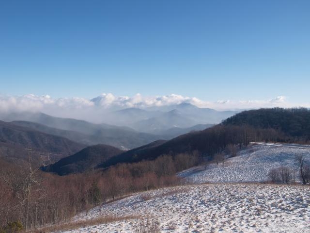
THE AMAZING GRACE OF MY MOUNTAINS

from 4 webcams aprox. 9am in The Smokies Feb. 14, 2013

Wednesday, February 13, 2013

LOOK ROCK MOODS


Look Rock webcam sits along the Foothills Parkway...a part of The Great Smoky Mountains National Park.  The webcam overlooks much of the park, particularly the Tennessee side.  That view has many moods.  Here are some of them.

Friday, February 8, 2013

Cherokees partner with Park on landslide repairs


Great Smoky Mountains News Release
Release Date: Immediate
Contacts: NPS: Dana Soehn, Dana_Soehn@nps.gov, 865-436-1207
Date: February 8, 2013
Park and Eastern Band of Cherokee Indians Partner to Offer Early Completion Incentive for Newfound Gap Road Repairs
 Great Smoky Mountains National Park and the Eastern Band of Cherokee Indians (EBCI) have partnered together to offer an early completion incentive for repairs to Newfound Gap Road (US 441) which was closed due to a January landslide. An extended road closure has significant economic implications for our tourism-based gateway communities.
 Park officials and the EBCI worked together to offer a monetary incentive of $ 18,000 per day to the selected contractor for each day of completion prior to May 15, 2013, up to a maximum of $500,000. The amount donated by the EBCI will apply to the first 14 days of the incentive period at the above rate.
 EBCI Principal Chief, Michell Hicks, and Park Superintendent, Dale Ditmanson, recognize the importance of Newfound Gap Road as a vital economic artery linking the NC and TN communities, as well as its importance to park visitors who enjoy the unique driving experience.
 “We are grateful that our Cherokee neighbors offered to match the National Park Service $250,000 incentive proposal in order to motivate the contractor to complete the rehabilitation of the road as efficiently as possible,” said Superintendent Ditmanson.
 In addition to the monetary incentives, the contract also includes monetary disincentives. The contractor will be charged $18,000 per day past May 15, 2013 to help insure the project is completed on schedule.
 The contracting piece for phase 2, involving the actual road reconstruction, was initiated on Friday January 25, when Federal Highways Administration (FHWA) posted a pre-solicitation for contractors with interest in repairing the landslide. Through this process a number of successful contractors submitted acceptable technical proposals and are now eligible to submit a bid to for the project. Bids from these contractors are due February 15, 2013. The contract for this phase of work is estimated to cost between $3,000,000 and $7,000,000. Final construction work will begin soon after.
 Phase 1 of the reconstruction project is on schedule. Phase 1 contract crews from APAC –Atlantic Harrison are in the process of building the haul road, stabilizing the site, and removing debris to prepare the site for Phase 2 reconstruction. Soil erosion mitigation efforts to stabilize the debris field and minimize siltation into Beech Flats Prong stream have been completed. In addition, Park biologists have completed all environmental compliance associated with the road reconstruction.
 Newfound Gap Road will remain closed to thru traffic during the construction, but visitors are still able to access the park to Newfound Gap from the TN side and to Collins Creek Picnic Area from the Cherokee, NC entrance.

Thursday, February 7, 2013

Great Smoky Mountains News Release


Park Roads Suffer Flood Damage

Great Smoky Mountains National Park suffered significant damage to park roads and trails following a flood event last week resulting in the temporary closure of sections of gravel roads within several popular areas. Closed areas include Greenbrier Road past the Greenbrier Ranger Station, Cataloochee Road past Palmer Chapel, and Parson’s Branch Road.
During the rain event on January 30th, the Park received over 4 inches of rain in 24 hours resulting in flooding of streams throughout the park which were already swollen from higher than normal precipitation throughout January. Average rainfall during January across the Park averages 5-7 inches of rain, but the Park received 14-17 inches of rain this January.
The gravel roads in Greenbrier, Cataloochee, and Parson’s Branch were washed out exposing underlying rock and culverts. Park crews are assessing the damage and estimate that repairs will be completed by the end of March. In addition to replacing culverts, roads will need to be graveled and re-graded.
High waters also destroyed the pedestrian bridge across Walker Camp Prong along the popular Chimney Tops Trail. The 70-foot long pedestrian bridge, originally built in the late 1950s, will have to be entirely replaced to allow trail access. Trail crews are assessing bridge replacement options and do not yet have a date estimate for completion

Friday, February 1, 2013

Great Smoky Mountains National Reschedules Prescribed Burn

Great Smoky Mountains News Release

Release Date: Immediate
Contact: Dana Soehn, Dana_Soehn@nps.gov
Phone number: 865-436-1207
Date: February 1, 2013

Great Smoky Mountains National Reschedules Prescribed Burn
Fire management officials at Great Smoky Mountains National Park have announced plans to conduct a 200 acre prescribed burn just inside the Park south of Wears Valley in Sevier County, Tenn. The burn is scheduled to occur sometime during the months of February through April. A local wind event canceled the burn back in November 2012. Prescribed burn operations are expected to take 2 days.
Great Smoky Wildland Fire Module, a National Park Service crew of wildland fire specialists, will be conducting the prescribed burn to reduce the build-up of flammable brush inside the Park boundary in order to reduce the risk of an uncontrolled fire. “Protecting our neighbors is a high priority,” stated Shane Paxton, Wildland Fire Module Leader. “Along with the positive ecological effects of controlled burning, we are reducing dangerous fuel loading near several homes which will help tremendously if there is ever a wildfire in the area.”
The planned burn area is bounded by Wear Cove Gap Road, Indian Camp Branch, Little River Road, and the Park boundary. In preparation for the burn, Wildland Fire Module personnel have been clearing brush and leaf litter along the Park boundary and Indian Camp Branch, which will serve as fire control lines to keep the fire within its planned boundaries. Park fire fighters and cooperator fire engines from Wears Valley Fire Department and Townsend Fire Departments will be prepositioned to patrol the lines and suppress any fire that threatens the containment lines.
This unit was also burned successfully in 2009. The burn is part of a multi-year plan to reduce fuel loadings in the Wildland Urban Interface (WUI) in Sevier County. Prescribed fire is a proven effective tool in returning forests to their pre-suppression splendor.
Closures for firefighter and public safety during burn operations include Wear Cove Gap Road from the Metcalf Bottoms bridge to the Park boundary at Wear Cove Gap along with Roundtop Trail. Residents should expect smoke in the area

2 EXCELLENT GSMNP WEBCAM LINKS


http://www.nature.nps.gov/air/webcams/parks/grsmcam/grsmcam.cfm

Tuesday, January 29, 2013


SMOKIES LANDSLIDE UPDATE 1/29/2013

Great Smoky Mountains News Release Update
Contact: Molly Schroer, Molly_Schroer@nps.gov
Phone number: 865-436-1203
Date: January 29, 2013
Landslide Work Progressing
Work is progressing to repair the landslide which has closed a section of Newfound Gap Road (U.S. 441) within Great Smoky Mountains National Park. Two key steps are already underway to initiate the reconstruction of the road.
A contract has been awarded for the first phase of work to APAC –Atlantic, Harrison Division to develop an access road to the slide area, remove debris, and stabilize the slope above the work area. This phase is estimated to cost around $200,000 and will prepare the site for the second phase of work which will involve a complete reconstruction of the roadway. This first phase began on January 28, and is expected to be completed in a few weeks.
The contracting piece for the second phase, involving the actual road reconstruction, was initiated on Friday January 25, when Federal Highways Administration (FHWA) posted a pre-solicitation for qualified contractors with interest in repairing the landslide. The contract for this phase of work is estimated to cost between $3,000,000 and $7,000,000, and is expected to be awarded by mid-February. Final construction work will begin soon after.
The schedule of the road reconstruction will be determined by the information received in the solicitation package, but is anticipated to be complete by mid-May to early June. Newfound Gap Road will remain closed to thru traffic during the construction, but visitors are still able to access the park to Newfound Gap from the Tennessee side and to Smokemont Campground from the Cherokee entrance.

Wednesday, January 23, 2013

NEW INFO ON GSMNP SLIDE AND ROAD

 
Great Smoky Mountains News Release Update
Contact: Molly Schroer, Molly_Schroer@nps.gov
Phone number: 865-436-1203
Date: January 23, 2013
Field Survey on Landslide Completed
 Great Smoky Mountains National Park officials have been working with the Federal Highways Administration (FHWA) to assess damage to Newfound Gap Road (U.S. 441) as a result of a January 16 landslide. The FHWA has completed their field survey work, and are now in the initial stage of preparation work to reconstruct the 200 linear feet of road.
 This first phase of work will include the stabilization of the slide, removal of landslide debris from the work area, and the completion of a path for construction vehicles to access the section of the slide below the roadway. The work is being coordinated by the FHWA and is expected to begin as early as next week.
 While the preparation work is taking place, the design of the road repair is in the development process. The road will be reconstructed as a reinforced full slope roadway. The design will allow for the drainage of water which will protect the road and park resources from future damage. This second phase will begin when the initial site preparation work has been completed. A timeline of completion cannot be determined until the final design has been developed and approved.
 “We recognize the importance of Newfound Gap Road to our neighboring communities in our tourism based economy,” said Superintendent Dale Ditmanson. “Therefore we are evaluating all reconstruction options to make sure the road work is completed in a timely but safe and efficient manner.”
The park is moving forward on re-vegetating the three acre debris field with native species to aid in sediment and erosion control. This measure will prevent run off from draining into the Beech Flats Prong stream located just below the slide area.
 While the access from Gatlinburg to Cherokee will remained closed during the construction period, Newfound Gap Road has been opened from the Gatlinburg, TN entrance to Newfound Gap, and from Cherokee, NC entrance to Smokemont Campground. Visitors who want to sightsee and recreate in the park will still find opportunities through both entrances.

Wednesday, January 16, 2013

MAJOR LANDSLIDE IN SMOKIES

Date: January 16, 2013, 5:40 pm
Update on Landslide on Newfound Gap Road
The first assessment of the landslide which occurred in Great Smoky Mountains National Park along Newfound Gap Road in North Carolina shows that the landslide is approximately 90,000 cubic yards of material or 350-400 feet. It is around the length of a football field and 45-50 feet deep. The slide is still active and an assessment team, made up of Park Staff and Federal Highways employees, observed debris continuing to fall.
The park still does not have an estimated time frame for the road to be open. Federal Highways and park staff are continuing to look at the site to assess options for repair and is hoping to have a rough estimate of a sometime in the next week. Inclement weather is expected over the next few days which may hinder the assessment team.
Further updates on the road condition will follow as details are determined.

Monday, January 7, 2013

LOOK ROCK webcam over time

Look Rock webcam along the Foothills Parkway, Blount County TN, a part of the Great Smoky Mountains National Park.  These are shots over many days in late fall 2012 and early winter 2012-2013

http://youtu.be/dBeEcRQL_FQ

Monday, November 12, 2012

THE SMOKIES MANY MOODS

http://youtu.be/9BH78d-qJco
100%
 
as seen from Look Rock webcam
on Foothills Parkway, Blount County, TN.